
Land Surveying, Civil Engineering & Town Planning Services in Sydney
Surveys
There are numerous types of land surveying services offered by YSCO Geomatics. Cadastral Boundary Surveys, Topographic (mapping) Surveys, and surveys for construction are the most requested. We utilise the latest technology to provide a rigorous and insightful service.
Our registered surveyors on staff are permitted by government legislation to define the boundaries of your land. Our surveyors are equipped with a wealth of experience in determining the location of those tricky boundaries that have become obscured over time.
No matter the project's size or scope, we can provide you with the necessary information for your design requirements. Our surveys are not limited to your land – we also provide a land and contour survey of your warehouse for high-rise racking purposes, the playing field to assist in drainage design, or your golf course to assist in the next "professionally designed" upgrade.
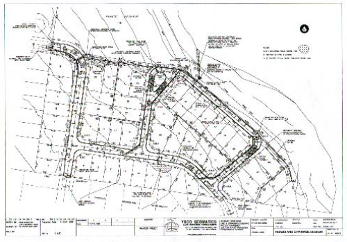
Designs
YSCO Geomatics is adept in various facets of design relevant to rural and urban land development. Our services provide road, drainage, stormwater and water-sensitive land design for proposed developments.


Project Management
We are able to manage your development from start to finish, including the appointment of professionals from other disciplines, preparation of tenders, supervision during construction, liaison with servicing authorities, and preparation of the final sale plans for use by your marketing professionals.
Over the last ten years, YSCO Geomatics has project-managed developments with a total net project value of over $0.5 billion and a construction value of over $300 million.
Shadow Diagrams
Our state-of-the-art digital terrain computer software allows us to input the design of your proposed building and, at the press of a button, determine the shadows that will be cast by it at any time, on any day of the year, or at any place on the surface of the earth.
Water Cycle Management
Water cycle management is an important consideration for urban development, which contributes to the ecological sustainability of a development.
Water cycle management covers:
Drinking water
Stormwater run-off
Waterway health
Sewage treatment
Recycling
Water Sensitive Urban Design (WSUD) is about the integration of water cycle management into urban planning and design.
YSCO Geomatics expertise primarily relates to the stormwater aspects of WSUD.
Sediment And Erosion Control
Sediment and erosion control measures are now a requirement of most developments where the land will be disturbed. Our qualified staff are able to prepare the necessary plans and documentation for submission to the council so that your development can get off to an early start.
Multi-Faceted Services
Our firm provides high-quality instruction and assistance in the following areas:
- Project Management
- Infrastructure Planning
- Geomatic Engineering
- Road and Drainage Design
- Land and Engineering Surveying
- Topographic Surveys
- Town Planning and Environmental Planning
- Urban Design
- Soil and Water Management
- Water Sensitive Urban Design (WSUD)
- Stormwater Detention Design
- Rainwater Storage Tank Design
All services are delivered with care at affordable and competitive rates, designed to assist you in all facets of the land development process.
